Why travel to Georgia and where to go
I was traveling across the Russian part of Caucasus 15 years ago, and there was an opportunity to visit this area again. This time on the Georgia side.
There were two interesting (and famous) areas I intended to visit - the Tusheti area and the Svaneti area. Because of the direct flight from Katowice to Kutaisi I chose the Svaneti area.
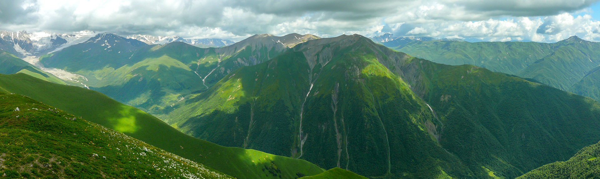
I wanted to see the famous mountains such as Ushba, Shkhara and perhaps touch a glacier.
How to prepare yourself
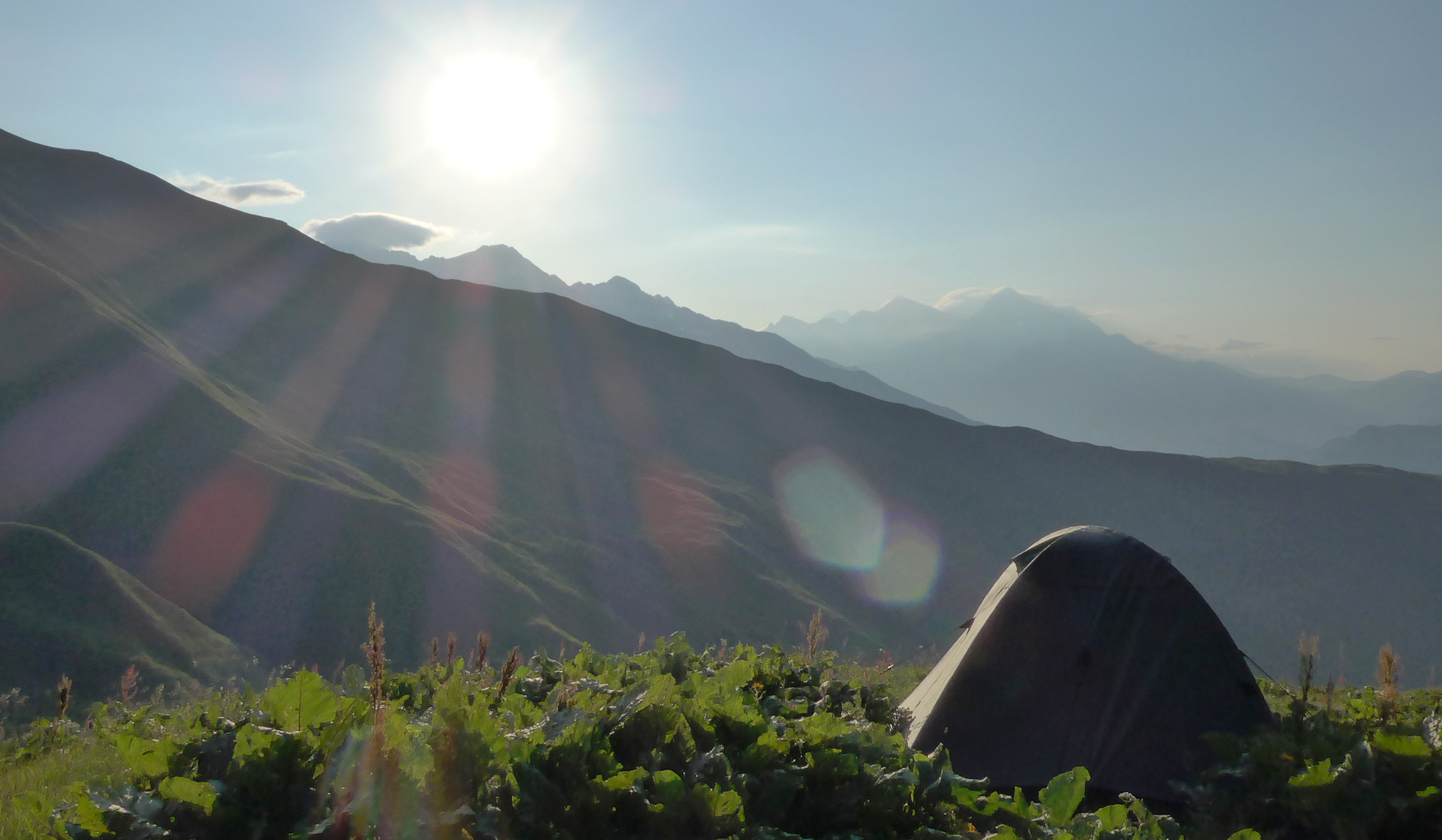
Preparation depends on how you want to spent your time in Georgia. If you want to travel across the mountains, sleep in a tent, cook your own food - you should have good travel gear with you.
You should know that in July and August there is extremely hot weather in the Svaneti area. So do not take your feather jacket, or winter sleeping bag because you will be sweaty all the time.
If you have enough cash with you, than you can sleep and eat in the villages with locals and you will need just a small bag with you. There is a lot of cattle everywhere which also means that there is lot of excrement.
Take some water-purification system with you (for example Steripen or Micropur tablets). If you intend to spend most of your time on your feet, you should be prepared for a lot of hill climbing.
Every day is the same - you will start in some village and then you will go up, in the middle of the day you will be on the top and then you will go down to some other village - it hurts sometimes. So train your thighs, ass and knees.
Maps and information about Georgia
- Paper maps - Most of the treks are quite short and you can do them in one day. Treks are marked quite well, so buy some map. It is not necessary to have a GPS with you (depends on your itinerary). You can get some elementary maps in Touristic center in Mestia (near the park and police office in the city center). Laminated Terra Quest map of Caucasus (1:75 000) is not bad, you can buy it in some e-shop.
- GPS maps - Open Street map for Garmin device. I have used two map layers in my Garmin device. I use the ordinary OSM exported layer and the contour lines layer. My device displays both together. You can get great OSM contour maps of georgia on this website: garmin.opentopomap.org
- Books - Lonely Planet - Georgia, Armenia & Azerbaijan travel guide
- Websites
What to do after landing at Kutaisi airport
When you get to Kutaisi airport, you can do several things.
- Exchange money - there is an exchange office with good rates (better rates then in Mestia). The exchange process is very complicated and slow, becouse every person has to fill in a lot of documents. So when you will get out the plane, run to the exchange office immediately...or you might have to wait for the exchange process even two hours. When you get to the arrival hall, you will find the office on the right side. You can use USD as well as EUR. You will get GEL - Georgian Lari.
- Buy a SIM card - there are 3 cell phone operators in Georgia: Magti (the best one), Geocell (second best) and Beeline (the worst). I am writing about the current situation (2016). Mobile services are extremely cheap in this country and coverage is surprisingly good. When you get to the arrival hall, there are kiosks of cell operators in the middle of the hall. When I got there, there were only the Geocell kiosk and Beeline kiosk (no Magti). So I bought the Geocell data SIM card (5GB for 12 GEL). Internet connection worked almost everywhere during the Svaneti trek except the Iprali area (Magti works there).
- Get the bus tickets - there is one other important kiosk in the arrival hall - the Georgian Bus kiosk. People there speak English very well, you can buy bus tickets there, or take tickets that you bought in advance and they will tell you all information you want to know. They will help you.
- Buy the gas cartridge - you can buy gas cartridge at the Georgian Bus kiosk as well. It is better to order it in advance - you should write them what kind of cartridge you prefer (Campingaz, Colleman...)
Transports in Georgia
Every man in Georgia is a taxi driver. Car transport is the best option when traveling. There are some companies that seem to be an official transport agency - for example the Georgian Bus, but I am sure that they are only coordinators and they order and then sell services of individual drivers. This means that sometimes you can get a good car and a good driver, sometimes not.
There are thousands of drivers that want to sell their services to you. When you ask them for a price offer, they want to sell their services as expensive as possible.
Negotiate! Every time negotiate. Young drivers are more aggressive, devious and unpleasant than older ones. Negotiation is easier with the older drivers because they want the job more. Be polite to them.
Cheaper way (than to rent a Jeep) is to share the Van. Most popular 4x4 outdoor Van there is a Mitsubishi Delica (8 people with driver included).
Schedule and GPS coordinates
Day 1 - Kutaisi airport - Mestia
Arrival to Kutaisi airport, exchange of money, buy gas cartridge, buy SIM card, manage transport to Mestia by Georgian Bus (it costs 40 GEL/person. You can get from Kutaisi to Mestia for 25 GEL in a shared Van, but it is more complicated). Transport Kutaisi-Mestia takes around 5 hours.
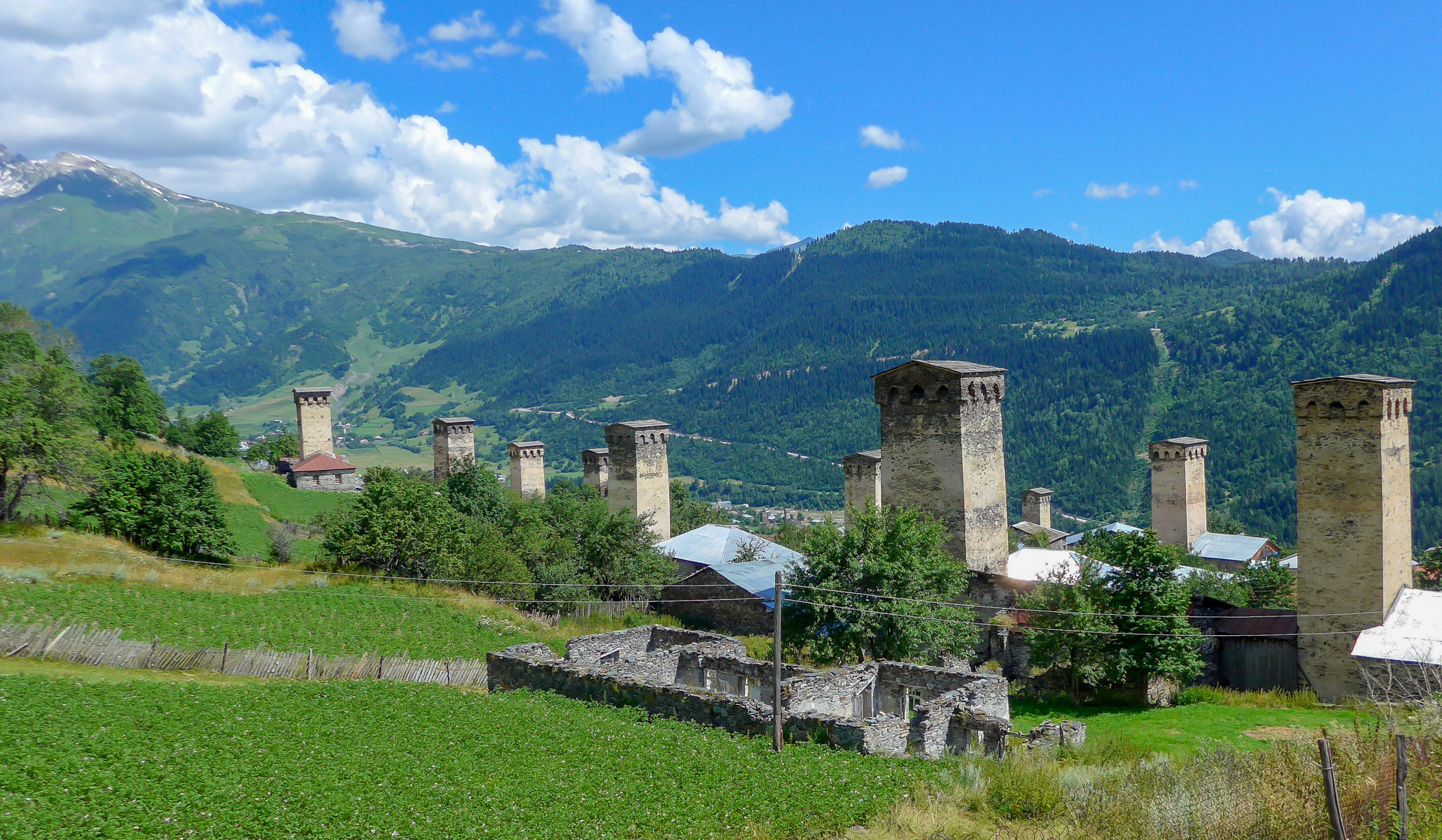
Buy Geoland treking map of Svaneti 1:50 000 in Mestia (souvenirs shop). Stay in some hostel or put your tent in the Camp (usually someone's garden). We camped almost behind the town. There is block of flats (right side) and among them the road leads to a house with a big garden, little lake and hammock near the entrance. Prices: 10 GEL/tent/2 person (bathroom included).
Day 2 - Mestia - Zhabeshi
Easy trek that I have planned in advance. There is a map of this trek and you can download GPS coordinates here. I'd recommend doing this trek in different way - at the view point (crossroads before Zardlashi village) follow the trail. We tried to follow the alternative path (to the left), but it was not a good idea.
There was a very steep hill and behind the horizon there is a land slide are. The path disappears for about 100m. It is a dangerous part. In the Cholashi village do not cross the river and do not follow the road (right side of the river). Follow the red marks by the river (on the left side) until you get to Zhabeshi.
Day 3 - Zhabeshi - Adishi
Next day you have a lot of elevation gain ahead of you. You have to get almost to the top of a piste (it is the new one, there is several paths to the top, you can lose the right way). Than you turn to the right and follow the nice path to Adishi. Adishi is really not a nice village. You can continue another 500m over the horizon. There is nice place for a tent on the right side of the path (around 100m behind the stream). Map of the trek is here, and you can download GPS coordinates as well.
Day 4 - Adishi - Iprali
We planned to do Adishi - Chkhunderi (the only hill over 3000m)-Khalde trek. At first we had to cross the river that comes from the Adishi Glacier. All travelers around us were speculating where to cross and were trying to find an easier ford in the upper or lower part of the river.
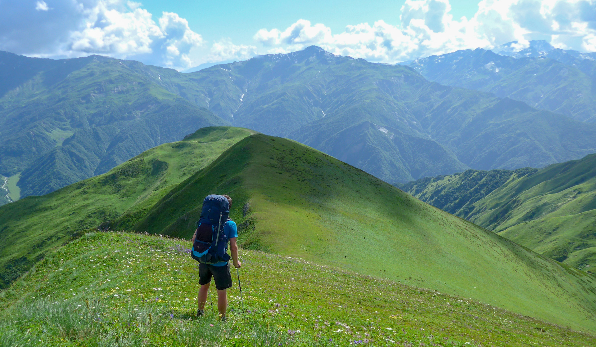
We crossed the river directly, we followed the trail and that is the right way. The flow was quite strong, but the river was not as deep as it seemed to be. Then we went up to the top of the hill to the crossroad (Khalde/Chkhunderi). We made the decision go to the top of Chkhunderi 3036m - it is actually quite far. When we got to the top, we found the best views till that moment.
There we got a great idea - not to go back to the crossroads and continue down to Khalde, but use a shortcut. In Terra Quest map there are 3 paths that lead from Chkhunderi to Iprali, so we tried to do it. It was a bad idea. The path disappeared in 30 minutes and it was very exhausting to get down to Iprali.
We had to cross several land slide areas, we had to get through a forest, paths nowhere. But finally we got to the Iprali. You can find a map of the planned trek here as well as the GPS coordinates. You'll find the coordinates of the trek that I recorded lower. There is a good campsite in Iprali - down at the right side of the village. Camp prices: 5 Gel/tent 5 Gel for bathroom.
Day 5 - Iprali - Ushguli
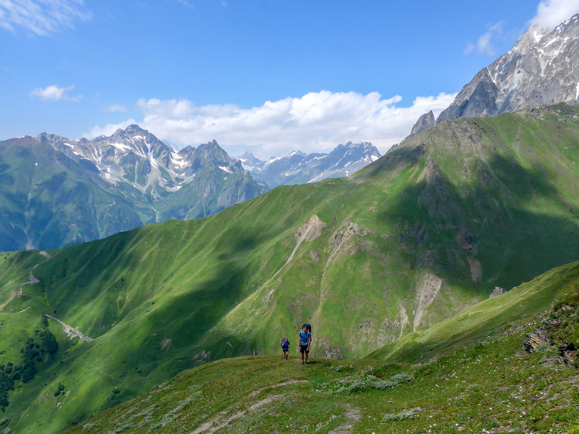
Next day we split up. Our friends followed the red trail and they continued to the Latphari Pass (scheduled GPS coordinates download and map). It's a long and really hard trek without any streams during the trek.
They told us they had great views up there, but the path was only good till the place before Gorvashi Pass. After that the path disappeared. It is in the Terra Quest map but not in reality. They could continue only because of the GPS in their cell phone (Alpenvereinactive app).
The two of us wanted to follow the less difficult path, but we did not want to use the main road as most trekkers. So I planned an alternative trek on the left side of the road with 600m of elevation gain. It was nothing special - just a path through meadows and forests - but better then the road down there (tens, maybe hundreds of vans were going to Ushguli - UNESCO village).
It was not easy to find the beginning of this trek, you have to go across someone's yard, but once on the road, you cannot miss the right direction. You can find a map of this alternative trek here. Here are the GPS coordinates of the Iprali-Ushguli trek.
Day 6 - Ushguli - Shkhara glacier - Ushguli
Ushguli is a UNESCO heritage village but definitely the most awful village I have seen (after the Adishi village). We put our tent down at the Guesthouse Oliver at the top of the hill, right next to the shop. They even promoted their guesthouse at the www.booking.com, but only half of their information is true.
You have to negotiate very carefully (write it down on paper) before you put your tent down, they want your money and when you want to leave, that want more than you negotiated at the beginning - especially if you order some food (you order something and they give you more than you have ordered and you have to pay it later). But it is almost the only place in Ushguli, where the ground is flat. Other camps are on the side of the hill. Prices: 10 GEL/person in tent, 5 GEL for bathroom.
We left our gear at the camp and we visited the Shkhara Glacier under the Shkhara mountain (5203m). Easy trek, but be careful with some of the numerous herb fields (Hogweed) on the way to the glacier. Because of short pants I got a bad skin allergy that affected me till the end of our travel.
There is also a base camp under the Shkhara Glacier, so you can sleep there. Map of Ushguli-Shkhara Glacier trek and GPS coordinates.
Day 7 - Ushguli - Mestia - day off
Next day we went back to the Mestia by van (Ford Transit). We negotiated the price day before, 6 people, 25 GEL/person. We came back to our favorite camp and then we spent rest of the day in the park at the center of Mestia - it was the only place with high trees and shadows. We ate bread (1 GEL), dry fish (5 GEL) and then we went to a restaurant.
Day 8 - Mestia - Chalaadi glacier -Mestia
Next day we visited the Chalaadi Glacier. I enjoyed only the last part of this trek (the forest part). The first part you have to follow the road and it is quite boring. My skin allergy was worse and worse. Map of the trek, GPS coordinates download.
Day 9 - Mestia - Etseri - trek to Mazeri
My skin allergy was frightening this day. We made the decision to split up again. I spent whole day in Mazeri (nice hostel in the middle of village - the only nice house in modern style) and my friends moved to Etseri and they did the Etseri-Mazeri trek. They said that it was beautiful and the trail was well marked. Map of this trek, GPS coordinates download.
The biggest problem was to get to these villages - almost all buses leave at 8am, and we got to the bus station at 10am. Nobody wanted to take us to these villages - or they wanted a ridiculous amount of money for it. So I started to negotiate with an older van driver and we made the deal 80 GEL for 4 people (Mestia-Mazeri-Etseri).
Day 10 - Mazeri - Ushba glacier - Mazeri
This day we visited the Ushba Glacier. We left all our stuff in the hotel and followed the marked path. It was not easy. You will have to overcome a big elevation gain to get to the Ushba glacier, but generally - the trek is nice. There are nice views and we enjoyed this. Map of Ushba Glacier trek, GPS coordinates download.
Day 11 - Mazeri- Guli pass ( Koruldi Lakes)
Next day we wanted to overcome the Guli Pass (2953m). It was quite a a lot of elevation gain. First part of the trek was clear - there was only one path. The second part leading to the Guli Pass was ambiguous. There were a lot of paths on the hill, but we followed the GPS coordinates on my Garmin device (in opposite direction) and it led us to the pass.
When we got there, we were completely exhausted and when we got about 100m down behind the Guli Pass we split up again. there were a few places for tents and a clear water stream - good place for camping.
Our friend continued to the Koruldi Lakes. We put our tent down and a magnificent thunderstorm came at night. Recorded GPS coordinates of the trek download.
Day 12 - Guli pass ( Koruldi Lakes) - Mestia
Next day, after the thunderstorm (5 hours!!!), we continued to the Koruldi Lakes. The path was on the side of the hill and we had to cross the river in one place. Unfortunately we were not able to do it. This place was extremely dangerous. Some part was covered with snow, but not enough (I am sure that the thunderstorm carried away a lot of it the night before). We tried to get over for at least 1 hour and we used up all possibilities (later we got an information from our friends, that the crossing over was extremely hard even before the thunderstorm, but they were lucky and they did it).
We came back to to the main river of the valley and we followed paths near the river toward the motor-road to Mestia. These paths sometimes got lost, there were a lot of them and some of them led to deserted huts for herdsmen.
This place was covered by 2m high nettles and thistles and the path led exactly through the center of this field of pain. This path was not a very good option. It took us about 4 hours to get down to the motor-road and then at least 1 hour on the road to the center of Mestia. Recorded GPS coordinates of the Guli Pass-Mestia trek.
In Mestia we met our friend who slept at Koruldi Lakes place. This trek was nicer despite the fact that it is not possible to swim in lakes (Koruldi lakes are very dirty and all the cows shit in them).
Day 13 - Mestia - Kutaisi
Next day we moved to Kutaisi. For transport we used the Georgian Bus company service again. When we used it for the first time after we arrived to Georgia, everything was OK. Good car, older, but a really good driver.
The way back was a horror experience. The driver was very young, he was driving very quickly and the worst thing - he was sleeping the whole time (because he does both ways - Kutaisi-Mestia and Mestia Kutaisi - without any break). We had to force him to take breaks and we had to force him to speak, because he kept closing his eyes the whole time.
When we arrived to the Kutaisi Park, we went to the Hostel center and chose accommodation (about 600 m from the main square (and Kutaisi Park) on Tsereteli Street - there are at least 3 hostels in a little courtyard - including the Hostel Paradise Road). Prices around 20 GEL/person/night.
Day 14 - Kutaisi - day off
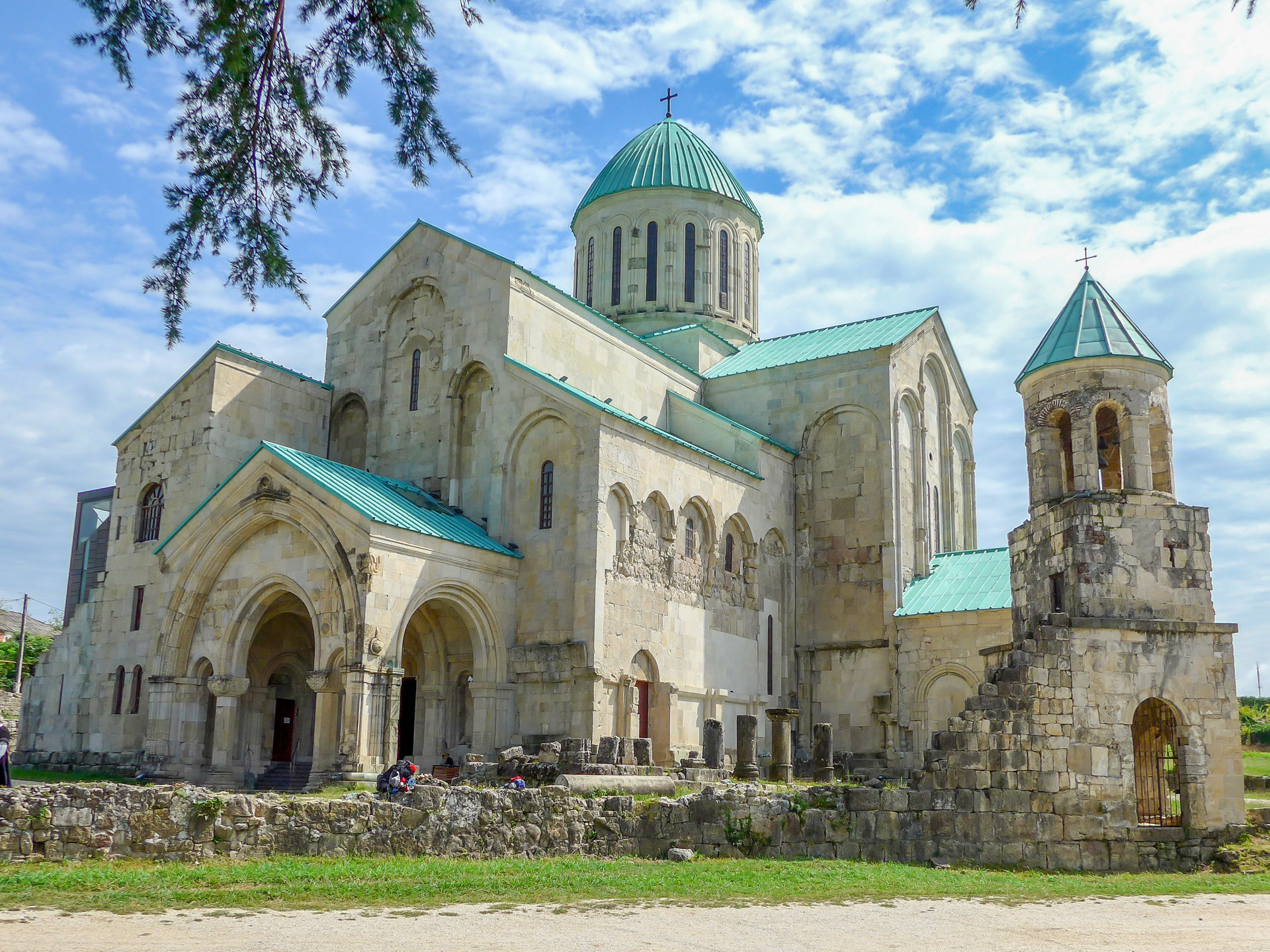
Next day we visited Bazar, Bagrati Cathedral, and Besik Gabashvili Park (old Ferris wheel and other attractions).
Day 15 - Kutaisi -Kutaisi airport
We got to the airport about 1 hour before midnight and we spent the night there (airplane was leaving at about 6 am). We got there by taxi, it cost about 30 GEL (4 person). This is where our travel adventures ended.